Burned area – Cerrado 2020
Last update: 03/19/2021
LASA has developed a warning system (called ALARMES, from Portuguese: Alarm system of Satellite-derived Burned area estimations ) that tracks the daily evolution of burned area over Pantanal and Cerrado. This is a joint initiative between our lab from UFRJ in Brazil and the Instituto Dom Luiz from the University of Lisbon, Portugal. Our system is currently being used by firefighters for planning and management during this fire season in Pantanal. The model is called BA-Net (from Burned Areas Neural Network – Pinto et al., 2020). The model uses daily top-of-atmosphere observations from NASA Visible Infrared Imaging Radiometer Suite (VIIRS) 375 m bands and VIIRS 375 m active fires product as inputs. The model is running for a near-real-time (NRT) mode and the output is daily maps of burned area with 500m spatial resolution.
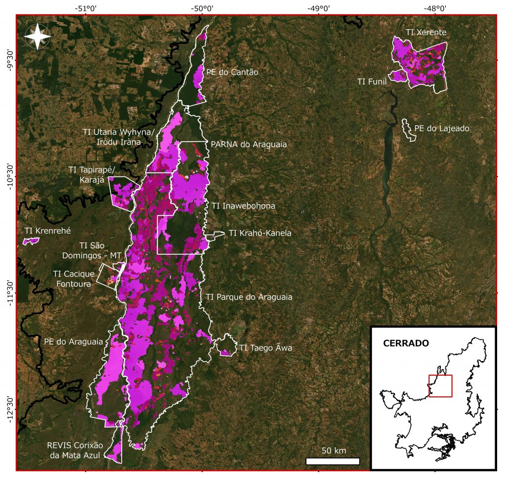
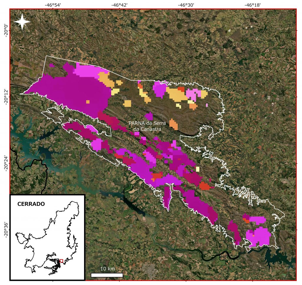
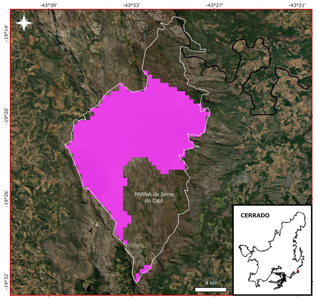
Please find in attach the quick view of the 2020 situation in Cerrado.
Obs.: Frequent asked questions here. (The English version is coming soon)
Obs.: Ask for dataset here lasa@igeo.ufrj.br.
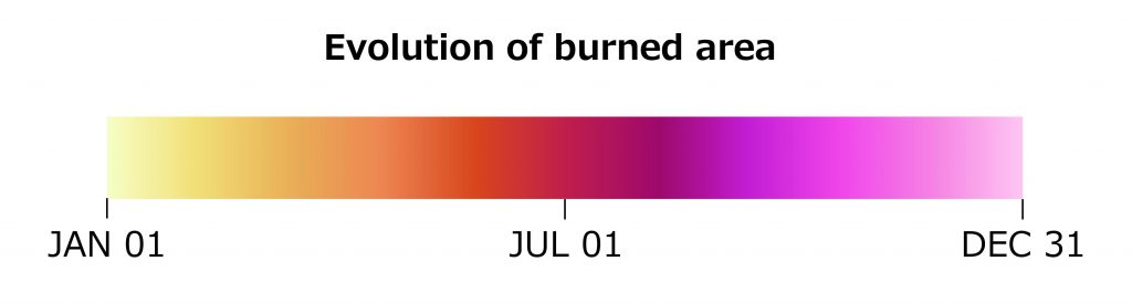
Situation: Jan 01 until Dec 31, 2020
Obs.: Obs.: All burned area data may show an error range of ± 20%.
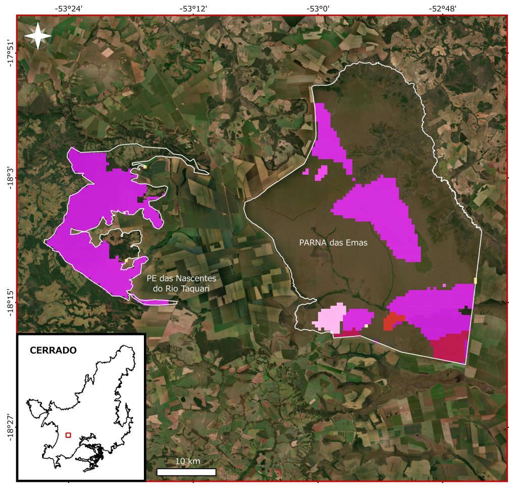
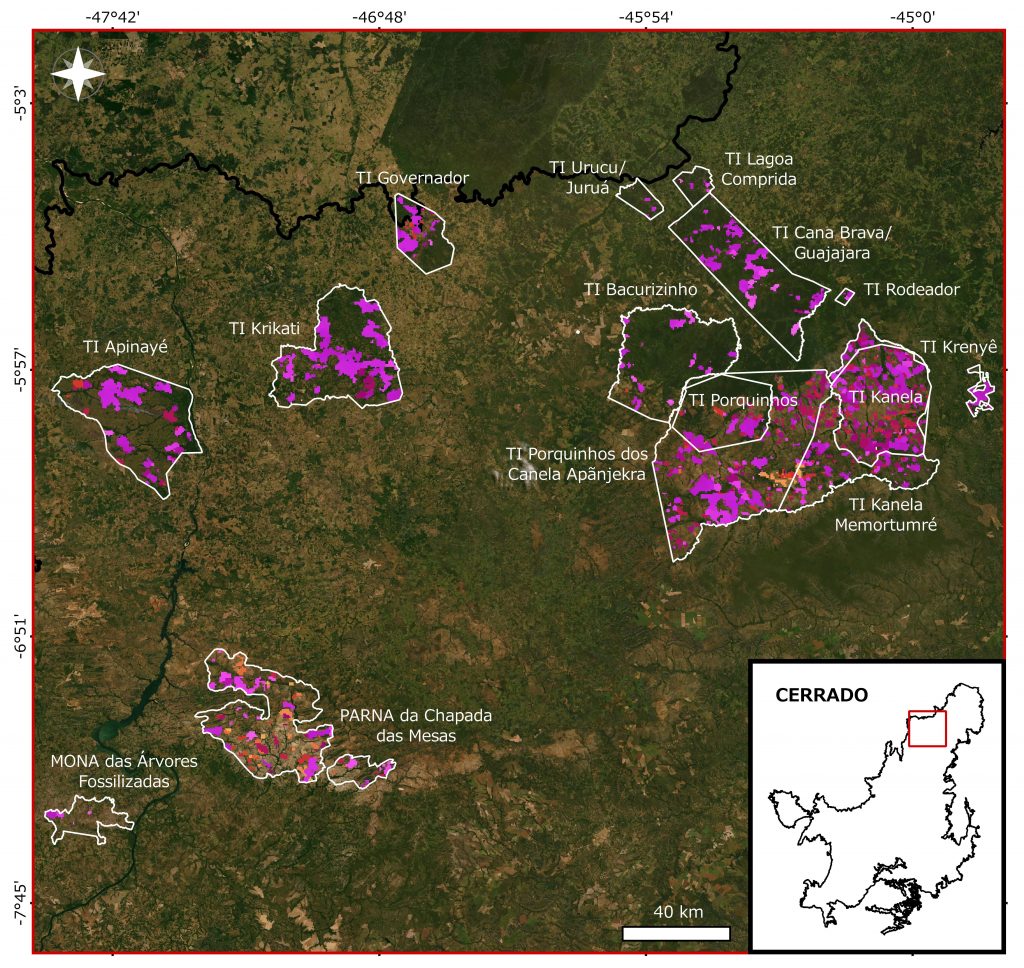
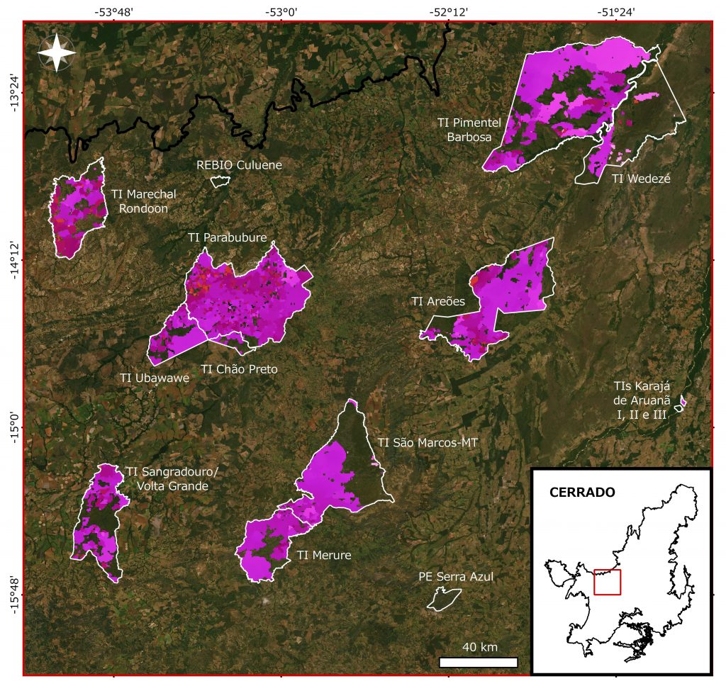
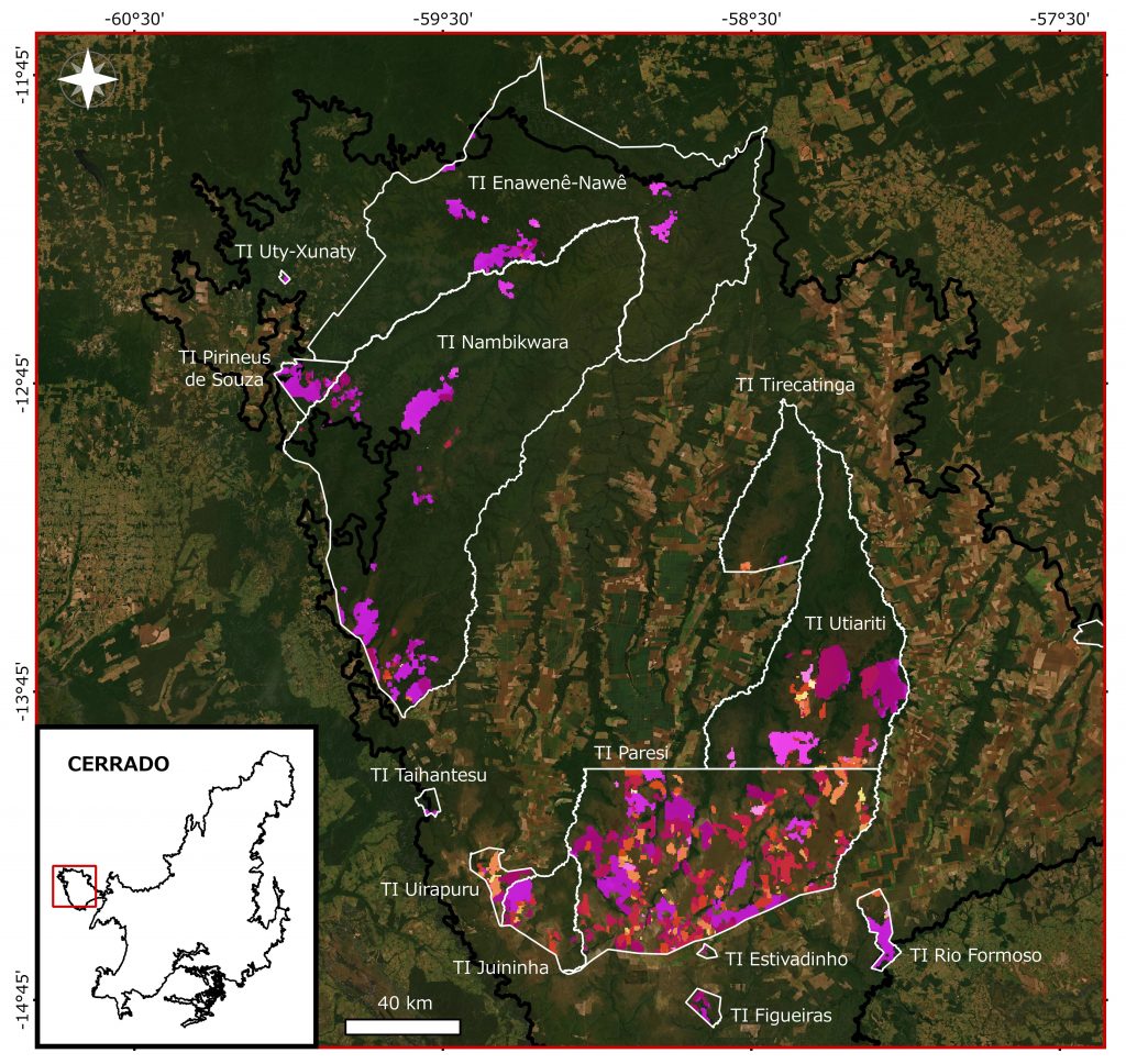
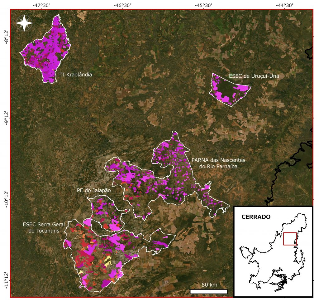
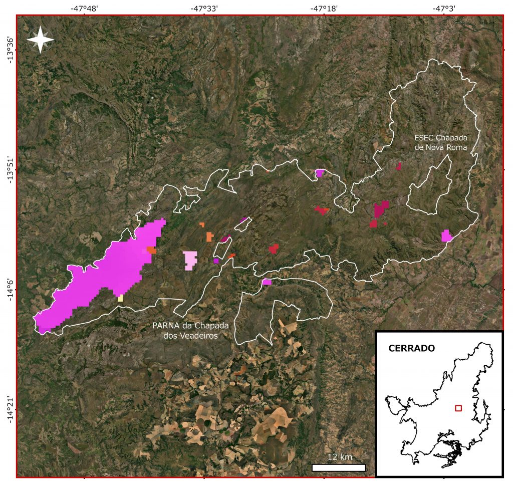
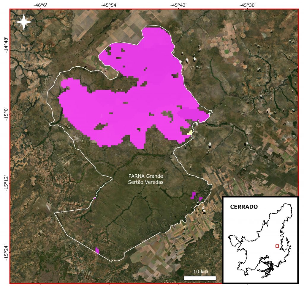
Obs.: The relative increase indicates the increase or decrease of burned area in 2020 compared to 2019. The Burned area 2020 (%) is the ratio between the burned area in 2020 and the region total area, in percentage.
In the media:
- Earth Observatory (08/27/20) – https://earthobservatory.nasa.gov/images/147269/fires-char-the-pantanal
- Nature (09/25/20) – https://www.nature.com/articles/d41586-020-02716-4
- Eco Americas (September v.22 n.11) – https://drive.google.com/file/d/1bgVDnDjSs0ihvuEOdqaHRzdv4JYokxbc/view?usp=sharing
- Ciência Hoje (20/10/20) – https://cienciahoje.org.br/artigo/um-futuro-de-calor-seca-e-fogo/
- Plurale em revista – edição 72 – https://www.plurale.com.br/newsletter/newsletter-2020-11-plurale-revista-edicao-72-ok.html
- Revista Pesquisa Fapesp ed. 297 – https://revistapesquisa.fapesp.br/o-pantanal-pede-agua/
A document with other media links can be accessed here.